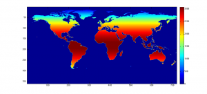
I use global data along a latitude-longitude grid fairly frequently. That can distort land areas pretty severely, but often that’s not a problem, if the data in question doesn’t scale with land area. But when it does, you need a new denominator. Here’s a dataset for that case.
It’s a .5 degree gridded dataset of land areas. For grid cells that are completely on land, that’s just a function of the latitude. On the coasts, I use a higher-resolution map of the coast contour to figure out how much land is in each cell. The values fluctuate a little artificially, because of how everything is calculated, but it’s generally within 1% of the correct value.
Download it here: 720×360 CSV


0 responses so far ↓
There are no comments yet...Kick things off by filling out the form below.